
Intense squall lines are severe weather formations that produce damaging winds, tornadoes, and flash flooding. They form when warm, moist air rises over cooler air, often along cold fronts. Historical events have shown their destructive capacity, leading to considerable property damage and utility disruptions. These phenomena pose risks to transportation and emergency response efforts. Understanding their characteristics and impacts can improve preparedness and community resilience. More knowledge into these intense systems await further exploration.
Main Points
- Intense squall lines can produce strong winds, tornadoes, hail, and flash flooding, leading to significant property damage and infrastructure disruption.
- Historical examples, such as the May 3, 1999, tornado outbreak, illustrate the catastrophic impacts of severe squall lines on communities.
- Advanced radar technology plays a crucial role in predicting squall line formation and movement, enhancing public safety through timely warnings.
- Severe weather from squall lines often results in extensive power outages and communication disruptions, complicating emergency response efforts.
- Preparedness strategies, like emergency plans and community engagement, are essential for mitigating the effects of intense squall lines on society.
Understanding Squall Lines: Origins and Characteristics
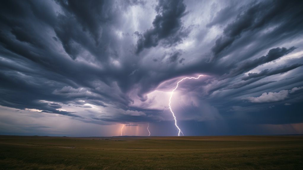
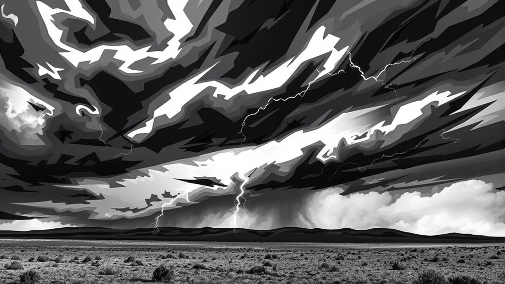
Squall lines are complex meteorological phenomena defined by a line of severe thunderstorms that can produce intense weather conditions. These lines typically extend over hundreds of miles and can form in various environments, often associated with cold fronts or other atmospheric disturbances.
Characteristically, squall lines exhibit a bowing shape, indicating strong winds and potential for damaging gusts. The leading edge of a squall line is marked by a rapid increase in wind speed and a sharp temperature drop, while the trailing edge is often accompanied by heavy precipitation and lightning.
These systems can generate severe weather events, including tornadoes, hail, and flash flooding. Their longevity and intensity make squall lines particularly hazardous, as they can persist for several hours, affecting large areas.
Understanding their characteristics is vital for meteorologists and the public to prepare for and respond to the severe weather they can produce.
The Formation Process of Squall Lines

While various atmospheric conditions can lead to the development of squall lines, they typically form when warm, moist air is lifted over a cooler, denser air mass. This lifting often occurs along a cold front, where the advancing cold air pushes underneath the warm air, causing it to rise rapidly.
As the warm air ascends, it cools and condenses, forming cumulonimbus clouds that can develop into a line of thunderstorms.
The process is further improved by wind shear, which refers to the change in wind speed and direction with altitude. This shear can organize storms into a linear structure, resulting in a squall line.
Additionally, the presence of a triggering mechanism, such as a surface low-pressure system, can also aid in the initiation of squall lines.
These factors combined contribute to the formation of intense squall lines capable of producing severe weather phenomena.
Historical Examples of Intense Squall Lines
Throughout history, intense squall lines have greatly impacted communities and terrains, often leaving behind a trail of destruction.
One notable example occurred in the Midwest United States on May 3, 1999, when a powerful squall line produced tornadoes and severe thunderstorms, resulting in extensive damage and loss of life in areas like Oklahoma.
Another notable event took place in April 2011, when a squall line swept through the southeastern U.S., generating damaging winds and contributing to one of the deadliest tornado outbreaks in history.
In Europe, the storm system that struck Germany in July 2019 showcased the devastating effects of squall lines, leading to widespread flooding and infrastructure damage.
These historical examples illustrate the deep and often catastrophic consequences that intense squall lines can inflict on various regions, emphasizing the need for effective monitoring and preparedness against such severe weather events.
Severe Weather Phenomena Associated With Squall Lines
Severe weather phenomena linked to squall lines include the heightened risk of tornado formation and flash flooding events.
These intense weather systems can generate conditions conducive to strong rotational winds, leading to tornadoes.
Additionally, the heavy rainfall often associated with squall lines can overwhelm drainage systems, resulting in considerable flooding.
Tornado Formation Risks
As squall lines develop and intensify, they can create conditions conducive to tornado formation, particularly in environments defined by strong wind shear and instability.
The interaction between warm, moist air at the surface and cooler, drier air aloft can lead to considerable atmospheric turbulence. Wind shear, which refers to changes in wind speed and direction with height, improves the rotation of air masses, increasing the likelihood of tornadoes.
Additionally, the presence of a dryline or frontal boundaries can further improve the potential for severe weather. Meteorologists closely monitor these factors, as they provide critical observations into the likelihood and intensity of tornado activity associated with squall lines.
Understanding these risks is essential for effective storm prediction and public safety measures.
Flash Flooding Events
Flash flooding frequently emerges as a notable consequence of intense squall lines, particularly when these systems stall or move slowly over an area. The heavy rainfall associated with squall lines can overwhelm drainage systems, leading to rapid water accumulation and hazardous conditions.
Urban areas are especially vulnerable due to impervious surfaces that limit natural absorption.
Key factors contributing to flash flooding events include:
- Intensity of Rainfall: High rates of precipitation can cause rivers and streams to rise quickly.
- Duration of Rainfall: Prolonged rain can saturate the ground, reducing its ability to absorb additional water.
- Topography: Regions with steep slopes can experience faster runoff, heightening the risk of flash floods.
Understanding these dynamics is essential for effective warning and preparedness strategies.
The Role of Meteorology in Predicting Squall Lines
Meteorology plays an essential role in predicting squall lines through advanced radar technology and thorough analysis of atmospheric conditions.
Radar systems provide real-time data that helps meteorologists identify the formation and movement of these intense weather phenomena.
Additionally, understanding the underlying atmospheric dynamics is vital for accurate forecasting and timely warnings.
Importance of Radar Technology
Advanced radar technology plays an essential role in the accurate prediction of squall lines and associated severe weather phenomena. By utilizing sophisticated radar systems, meteorologists can detect and analyze the formation and development of squall lines in real-time.
This technology enables timely warnings and effective preparedness measures to mitigate the impact of severe weather.
Key benefits of radar technology include:
- Early Detection: Identifies the initial formation of squall lines, allowing for prompt alerts.
- Real-Time Monitoring: Provides continuous updates on the movement and intensity of severe weather, aiding in accurate forecasting.
- Data Integration: Combines radar data with other meteorological information, enhancing comprehensive situational awareness and prediction accuracy.
These advancements greatly improve public safety and response strategies during severe weather events.
Atmospheric Conditions Analysis
Understanding atmospheric conditions is essential for predicting the formation and behavior of squall lines. Meteorologists analyze various factors, including temperature, humidity, and wind patterns, to assess the likelihood of squall line development.
Key indicators include unstable air masses, which can lead to rapid vertical development, and the presence of a strong cold front that forces warm air upward. Additionally, the wind shear, or change in wind speed and direction with altitude, plays a critical role in enhancing storm organization and longevity.
Impacts on Communities and Infrastructure
Intense squall lines can release devastating effects on communities and infrastructure, often leading to considerable disruptions and damage. These weather events typically bring strong winds, heavy rain, and hail, which can compromise the safety and functionality of various structures. The consequences are particularly pronounced in urban areas where densely populated environments face increased risks.
Key impacts include:
- Property Damage: Homes, businesses, and vehicles can sustain severe damage from high winds or falling debris, leading to costly repairs.
- Utility Disruptions: Power outages are common, as strong winds may down power lines, leaving communities without electricity for extended periods.
- Transportation Challenges: Roads can become hazardous due to flooding, debris, or fallen trees, impeding emergency services and daily commutes.
The cumulative effect of these factors can strain local resources and hinder recovery efforts, making the management of intense squall lines essential.
Preparedness Strategies for Severe Weather Events
As communities face the increasing threat of severe weather events, effective preparedness strategies become vital in mitigating potential impacts. Developing a thorough emergency plan allows households to respond swiftly, ensuring that all members understand their roles during a crisis.
Communities should invest in early warning systems to provide timely alerts, enabling residents to take appropriate action. Education and training programs can equip individuals with knowledge about severe weather patterns and safety measures.
Additionally, establishing local emergency response teams can improve community resilience, facilitating coordinated efforts during disasters. Stocking emergency kits with essential supplies, including food, water, and medical items, is significant.
Regular drills and community engagement initiatives nurture a culture of preparedness, ensuring that individuals remain vigilant. By prioritizing these strategies, communities can strengthen their ability to withstand severe weather events, ultimately reducing the risk of injury and damage.
Common Questions
How Do Squall Lines Differ From Other Storm Systems?
Squall lines differ from other storm systems primarily in their organization and structure. They typically feature a narrow band of intense thunderstorms, contrasting with broader systems that may exhibit more widespread precipitation and varied intensity.
Can Squall Lines Produce Tornadoes?
Squall lines can indeed produce tornadoes, particularly when conditions are favorable. The interaction of strong winds, moisture, and instability can lead to the development of rotating updrafts, increasing the likelihood of tornado formation within these systems.
What Are the Signs of an Approaching Squall Line?
Signs of an approaching squall line include darkening skies, rapidly increasing winds, a noticeable temperature drop, and the appearance of towering clouds. Often, rain or hail precedes the line, signaling imminent severe weather conditions.
How Do Squall Lines Affect Air Travel?
Squall lines greatly affect air travel by causing turbulence, leading to flight delays and diversions. Pilots must maneuver around these severe weather systems to guarantee passenger safety, resulting in altered flight paths and extended travel times.
Are Squall Lines More Common in Certain Regions?
Squall lines occur more frequently in regions with considerable atmospheric instability, particularly in the central United States. Warm, moist air colliding with cooler air often triggers these phenomena, especially during spring and summer months.