
Satellite images of squall lines reveal their striking formations and the intensity of severe weather. These images highlight the organized bands of thunderstorms, showcasing features like anvil-shaped clouds and gust fronts. Advanced technology enables the capture of these dramatic visuals, allowing meteorologists to study their impact on local climates. Notable historical squall line events further illustrate their significance. Exploring these enthralling images reveals a deeper understanding of their powerful influence on weather patterns.
Main Points
- Satellite images reveal the dramatic formation of squall lines, showcasing their intricate structure and the anvil-shaped clouds associated with severe weather events.
- Advanced imaging techniques capture the intensity of thunderstorms, highlighting features like gust fronts and mammatus clouds indicative of turbulence.
- Geostationary satellites provide real-time monitoring, allowing for striking visuals of squall lines as they develop and transform across landscapes.
- High-resolution satellite imagery enhances our understanding of precipitation patterns, illustrating the potential for flash flooding and severe weather impacts.
- Artificial intelligence analyzes satellite data to identify severe weather patterns, improving the visualization and forecasting of squall lines and associated phenomena.
Understanding Squall Lines: Definition and Formation
Squall lines are a distinct meteorological phenomenon defined by a narrow band of thunderstorms. These systems typically form along a cold front or a dry line, where warm, moist air meets cooler, denser air.
The lifting of the warm air initiates convection, leading to the development of cumulonimbus clouds. As these clouds grow, they can organize into a line, often extending for hundreds of miles.
The formation of squall lines is influenced by various atmospheric conditions, including wind shear, which improves their longevity and intensity.
Typically, squall lines can produce severe weather, including heavy rainfall, strong winds, hail, and even tornadoes. Their rapid onset and potential for severe impacts make them a notable concern for meteorologists and those in affected regions.
Understanding squall lines is essential for effective weather forecasting and disaster preparedness.
The Anatomy of a Squall Line: Key Features
The anatomy of a squall line includes several key features that define its formation and structure.
Understanding the distinct cloud formations and the associated weather phenomena is essential for predicting their impact.
This overview will highlight the critical components that characterize these dynamic systems.
Formation Process Overview
While various weather phenomena can exhibit unique traits, squall lines are particularly notable for their distinct formation process.
These lines typically develop along a cold front, where warm, moist air rises rapidly over the denser, cooler air. As this warm air ascends, it cools and condenses, creating large amounts of cumulonimbus clouds.
The resulting instability in the atmosphere can lead to the development of strong winds, heavy rain, and severe thunderstorms.
Additionally, squall lines often extend for hundreds of miles, distinguished by a well-defined leading edge known as a gust front.
This gust front can trigger additional thunderstorm activity, enhancing the overall intensity and longevity of the squall line, making it a considerable weather event to monitor.
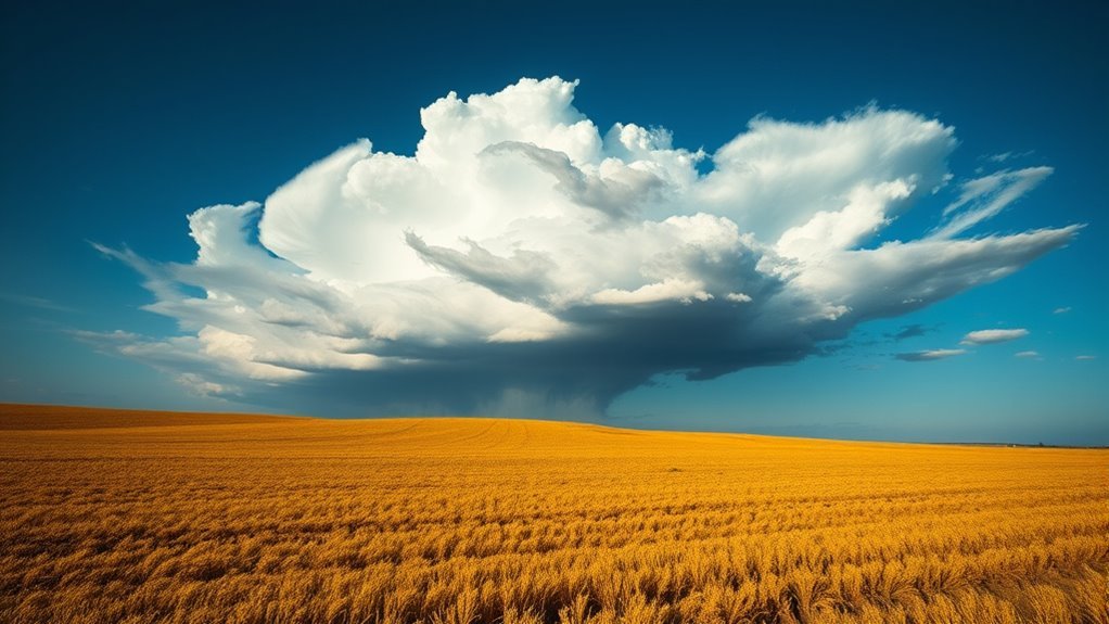
Distinct Cloud Structures
Cumulonimbus clouds serve as the hallmark of a squall line, showcasing distinct features that contribute to its intensity and dynamics.
These towering clouds often exhibit a characteristic anvil shape, formed by strong updrafts that push moisture-rich air high into the atmosphere. The presence of a well-defined shelf cloud marks the leading edge of the squall line, indicating violent weather conditions ahead.
Additionally, the cloud base is typically low, enhancing the likelihood of severe weather phenomena. The vertical development of these clouds can reach impressive heights, often extending into the stratosphere.
Accompanying features, such as mammatus clouds, may appear, further illustrating the turbulent nature intrinsic to squall lines.
Collectively, these structures provide essential understanding into the atmospheric processes at play.
Associated Weather Phenomena
As squall lines develop, they are often accompanied by a variety of severe weather phenomena that can pose considerable risks.
These phenomena include intense wind gusts, heavy rainfall, hail, and even tornadoes. The leading edge of a squall line, known as the gust front, can generate strong downdrafts, resulting in damaging winds that extend far beyond the storm itself.
Heavy precipitation can lead to flash flooding, particularly in urban areas with poor drainage systems. Additionally, hail can form in the updrafts of the storm, causing notable damage to crops and property.
Tornadoes may also spawn in the most severe sections of a squall line, posing a serious threat to life and infrastructure.
Understanding these associated phenomena is essential for effective weather preparedness and safety.
Satellite Technology: How We Capture Weather Images
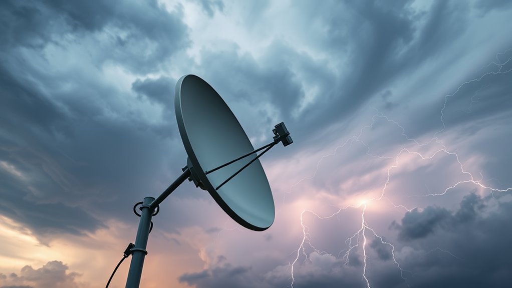
Satellite technology employs advanced imaging techniques to capture detailed weather images from space.
These methods, coupled with sophisticated data processing, enable meteorologists to analyze severe weather patterns accurately.
Understanding these technologies is essential for improving weather forecasting and response efforts.
Advanced Imaging Techniques
While capturing weather images has evolved considerably over the years, advanced imaging techniques have become essential for monitoring severe weather phenomena.
Modern satellites utilize a combination of multispectral and hyperspectral imaging to capture detailed atmospheric data across various wavelengths. These techniques allow meteorologists to observe temperature variations, moisture content, and cloud formations with exceptional accuracy.
High-resolution imagery from geostationary satellites provides real-time monitoring, enabling timely warnings for impending storms. Additionally, synthetic aperture radar improves the ability to analyze precipitation patterns and wind dynamics.
Data Processing Methods
Data processing methods play a crucial role in transforming raw satellite imagery into actionable weather information. The process begins with data acquisition, where sensors on satellites capture detailed images of Earth's atmosphere.
These images undergo calibration to correct for atmospheric distortions and sensor anomalies. Following this, advanced algorithms analyze the data, extracting critical features such as cloud patterns, temperature variations, and moisture levels.
Techniques like image improvement and filtering improve visual clarity, allowing meteorologists to interpret the data effectively. Additionally, machine learning models increasingly assist in identifying severe weather phenomena, boosting prediction accuracy.
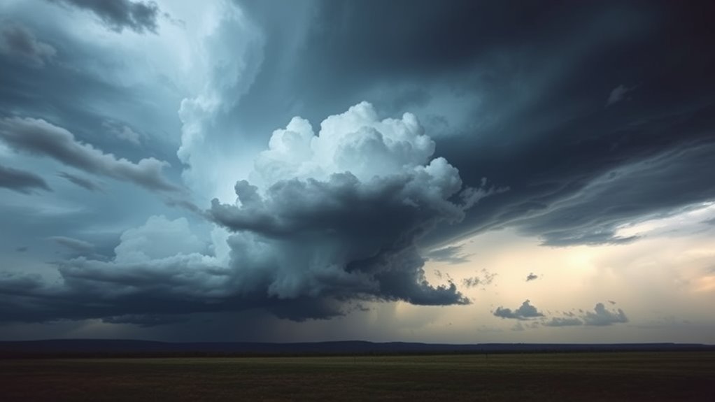
Dramatic Visuals: Stunning Images of Squall Lines
Squall lines, defined by their striking formations and intense weather activity, present an enchanting spectacle for both meteorologists and enthusiasts alike. These long, narrow bands of thunderstorms exhibit dramatic visuals, often marked by their well-defined edges and vibrant colors.
Satellite images capture the complex details of these formations, revealing the dynamic interplay between clouds and precipitation. The contrast between the dark, ominous clouds and the lighter areas of clear sky highlights the powerful updrafts and downdrafts that define squall lines.
Additionally, the swirling patterns and the development of shelf clouds can be vividly observed, showcasing the chaotic nature of severe weather. Such imagery not only serves as a tool for weather prediction but also offers a visual feast for those fascinated by the forces of nature.
In the end, the stunning visuals of squall lines remind viewers of the awe-inspiring power and beauty fundamental in severe weather phenomena.
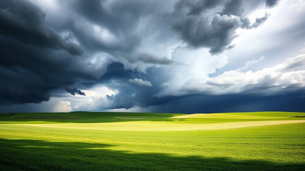
The Impact of Squall Lines on Local Weather Patterns
As squall lines move through an area, they can greatly alter local weather patterns, often leading to rapid changes in temperature, wind direction, and precipitation levels. These weather phenomena typically bring intense thunderstorms, resulting in sudden downpours that can cause flash flooding.
The gusty winds associated with squall lines can shift dramatically, creating turbulence and potentially damaging conditions. Furthermore, squall lines can influence the distribution of atmospheric moisture, leading to varying humidity levels across affected regions.
Following the passage of a squall line, a noticeable drop in temperature may occur, especially in summer months, as cooler air is ushered in. Additionally, squall lines can trigger severe weather events, such as hail and tornadoes, posing risks to both life and property.
Understanding these impacts is essential for effective weather forecasting and preparedness in vulnerable communities.
Notable Squall Line Events: A Historical Perspective
Throughout history, several notable squall line events have substantially impacted communities and altered local weather dynamics. One of the most infamous occurrences was the 2011 Joplin tornado, which formed in conjunction with a powerful squall line, resulting in catastrophic destruction and loss of life.
Similarly, the squall lines that swept through the Midwest in 1974 contributed to the Super Outbreak, one of the largest tornado outbreaks in U.S. history. These events demonstrated the destructive potential of squall lines, which can spawn severe thunderstorms, damaging winds, and tornadoes.
In 1999, a squall line in Oklahoma produced wind gusts exceeding 100 mph, leading to extensive property damage and prompting advancements in storm prediction.
Such historical events underscore the importance of understanding squall lines, as they serve as vital indicators of severe weather and have shaped meteorological practices in forecasting and monitoring severe weather phenomena.
The Future of Weather Monitoring: Innovations in Satellite Imagery
Innovations in satellite imagery have revolutionized the field of weather monitoring, allowing meteorologists to track severe weather events with unparalleled accuracy. Advanced satellite technologies, including high-resolution imaging and real-time data transmission, improve the ability to observe atmospheric conditions.
Advanced satellites provide three-dimensional views of storm systems, enabling forecasters to analyze temperature, humidity, and wind patterns more effectively.
Furthermore, artificial intelligence plays a vital role in interpreting extensive amounts of satellite data, identifying patterns that may indicate severe weather development. The integration of machine learning algorithms allows for quicker assessments and improved predictive capabilities.
Future developments promise even more sophisticated instruments capable of detecting minute changes in weather systems. These advancements will not only improve early warning systems but also contribute to climate research, providing deeper understanding into changing weather patterns.
As technology progresses, the accuracy and efficiency of weather monitoring will continue to evolve, ultimately safeguarding communities from severe weather threats.
Common Questions
How Do Squall Lines Differ From Other Storm Systems?
Squall lines are defined by their linear structure, forming ahead of cold fronts, and typically produce severe weather such as heavy rain and strong winds, distinguishing them from more isolated thunderstorm systems that develop randomly.
Can Squall Lines Cause Tornadoes?
Squall lines can indeed produce tornadoes, particularly when strong wind shear and instability are present. These conditions can lead to rotating updrafts, increasing the likelihood of tornado formation within or near the squall line.
What Safety Precautions Should Be Taken During a Squall Line?
During a squall line, individuals should seek shelter indoors, avoid windows, secure outdoor objects, monitor weather updates, and prepare for potential power outages. Staying informed and prepared improves safety amidst rapidly changing weather conditions.
Are Squall Lines More Common in Certain Seasons?
Squall lines are indeed more common during specific seasons, particularly in spring and summer. These periods provide the necessary atmospheric conditions, such as increased warmth and humidity, which contribute to the development of these severe weather phenomena.
How Can I Track Squall Lines in Real-Time?
To track squall lines in real-time, individuals can utilize weather radar apps, follow meteorological websites for updates, and monitor social media platforms for alerts from weather services, ensuring timely awareness of severe weather developments.