
Gust fronts and downdrafts play essential roles in squalls, greatly affecting wind speed variations and atmospheric dynamics. Gust fronts form when cold air from downdrafts interacts with warmer, moist air, creating sharp temperature contrasts and strong winds. Downdrafts improve surface conditions, leading to localized turbulence and impacting aircraft stability. Understanding these interactions is important for forecasting and situational awareness. Exploring these phenomena further reveals their complexities and consequences for weather forecasting and aviation safety.
Main Points
- Gust fronts form when cold air downdrafts meet warm, humid air, creating sharp temperature contrasts and initiating new convective activity.
- Strong downdrafts enhance surface wind speeds, resulting in gust fronts that significantly impact local weather conditions and turbulence.
- Wind speed variations due to downdrafts can disrupt aircraft stability, particularly during critical phases like takeoff and landing.
- Continuous monitoring of wind conditions using Doppler radar and ground-based weather stations is essential for forecasting squall-related wind variations.
- Training and public awareness programs can improve recognition of gust fronts and downdrafts, enhancing safety and preparedness for wind-related events.
Understanding Gust Fronts: Definition and Characteristics
Gust fronts are essential meteorological phenomena that occur when cold air from downdrafts interacts with warmer, humid air at the surface. These boundaries are formed as a result of precipitation-induced cooling, where the downdrafts displace colder air downward, creating a sharp contrast with the surrounding air.
The shift zone of a gust front is marked by a rapid change in temperature and wind speed, which can lead to turbulent conditions. Typically, gust fronts extend outward from the storm, often several kilometers away, and can travel ahead of the associated thunderstorm.
They can trigger new convective activity by lifting the warm, moist air into the atmosphere, potentially leading to the development of additional storm cells. As gust fronts move, they may produce strong, gusty winds and localized downdrafts, impacting the surface conditions and influencing weather patterns in the vicinity.
Understanding these features is essential for meteorological forecasting.
The Role of Downdrafts in Squall Formation

Downdrafts play an important role in the formation of squalls by facilitating the downward movement of cool, dense air.
These downdrafts can greatly influence the intensity of squalls, contributing to their severity and structure.
Understanding the mechanisms behind downdraft formation is essential for grasping their impact on squall dynamics.
Downdraft Formation Mechanisms
The formation of downdrafts plays a critical role in the development of squalls, acting as a key mechanism that influences storm dynamics.
These downdrafts arise from various processes, each contributing to their intensity and characteristics. Understanding these mechanisms is essential for comprehending squall behavior.
The primary factors involved in downdraft formation include:
- Cooling of Air: Evaporation and precipitation cool air parcels, increasing their density.
- Momentum Transfer: Strong winds aloft can transfer momentum downward, enhancing downdraft strength.
- Convergence Zones: The interaction of different air masses can lead to localized downdraft production.
- Topographical Influences: Terrain features can alter wind patterns, promoting downdraft initiation.
Together, these mechanisms explain how downdrafts contribute to the comprehensive complexity of squall systems.
Impact on Squall Intensity
As squalls develop, the intensity of these storms is considerably influenced by the presence and behavior of downdrafts.
Downdrafts, resulting from the cooling air descending rapidly within a squall, can boost surface wind speeds and lead to the formation of gust fronts. These gust fronts push out ahead of the storm, causing a dramatic increase in convergence at the surface.
Consequently, this convergence can intensify the squall by promoting further updrafts and increasing precipitation rates. Additionally, strong downdrafts can result in localized damaging winds, contributing to the general storm severity.
The dynamics between downdrafts and the surrounding atmospheric conditions play a key role in determining the intensity and potential hazards associated with squall events.
How Gust Fronts Influence Wind Speed Variations
While gust fronts primarily form as a result of downdrafts from thunderstorms, their impact on wind speed variations can be considerable.
These phenomena can alter local wind patterns and create sudden shifts in intensity. The influence of gust fronts on wind speed can be observed in several ways:
- Acceleration of Surface Winds: As cold air from downdrafts spreads out, it can lead to a rapid increase in wind speed at the surface.
- Directional Changes: Gust fronts can shift wind direction, often leading to erratic gusts that can surprise observers.
- Formation of Shear Zones: The interaction between the gust front and pre-existing winds can create shear zones, resulting in localized turbulence.
- Propagation of Wind Changes: The gust front can propagate outward, impacting a broader area and causing widespread wind speed variations over time.
These factors contribute to the complexity of wind behavior during squalls.
The Interaction Between Downdrafts and Gust Fronts

The interaction between downdrafts and gust fronts plays a vital role in the dynamics of squall systems.
Downdrafts, defined by descending air, contribute to the formation of gust fronts, which mark the leading edge of cold air.
Understanding these processes is essential for predicting wind patterns and storm behavior.
Downdraft Dynamics Explained
Understanding the dynamics of downdrafts is essential to grasping how they interact with gust fronts in squall conditions.
Downdrafts occur when cool, dense air descends rapidly, creating considerable changes in wind patterns. These downdrafts can strengthen gust fronts, leading to abrupt shifts in wind direction and speed.
The following points highlight key aspects of downdraft dynamics:
- Formation: Downdrafts develop from precipitation and evaporative cooling, resulting in cooler air sinking.
- Interaction: When downdrafts meet the surface, they can trigger gust fronts, pushing air outward.
- Intensity: The strength of downdrafts can vary based on the surrounding atmospheric conditions.
- Impact: Downdrafts may lead to turbulence and severe weather phenomena, affecting local environments markedly.
Gust Front Formation Process
Gust fronts form as a direct result of the interaction between downdrafts and the surface environment. As downdrafts descend from a thunderstorm, they bring cooler, dense air that displaces the warmer air near the surface.
This abrupt change in temperature and pressure leads to the formation of a gust front, which can extend outward from the storm. The collision of the downdraft's cold air with the surrounding warm air creates a boundary layer, causing a surge in wind speed.
This phenomenon can improve local wind patterns, leading to increased turbulence and potential wind damage. As the gust front propagates, it can trigger new convective activity, further influencing the dynamics of the storm system.
Understanding this interaction is essential for predicting severe weather events.
Observational Techniques for Monitoring Squalls
Effective monitoring of squalls requires a variety of observational techniques that can capture their rapid development and intense characteristics. These methods help meteorologists and researchers understand the dynamics involved in squall events, enabling timely warnings and effective responses.
- Radar Systems: Doppler radar provides real-time data on wind speed, precipitation, and storm structure, allowing for the identification of squall lines and associated downdrafts.
- Satellite Imagery: Geostationary satellites offer large-scale observations of cloud formation and movement, which assist in tracking the development and progression of squalls.
- Weather Stations: Ground-based stations measure temperature, humidity, and wind speed, providing localized data that is essential for understanding squall impacts.
- Lidar and Sodar: These remote sensing technologies assess atmospheric conditions and wind profiles, contributing significant information about the vertical structure of squalls.
Together, these techniques form a thorough framework for monitoring squall activities.
Impacts of Wind Speed Variations on Aviation Safety
As wind speed variations can greatly influence flight operations, their impacts on aviation safety cannot be overlooked. Sudden gusts and downdrafts associated with squalls can lead to notable turbulence, affecting aircraft stability and control.
Pilots may experience difficulty in maintaining altitude and direction, increasing the risk of accidents during takeoff and landing. In addition, unexpected changes in wind speed can disrupt approach patterns, complicating the landing process and potentially leading to runway excursions.
The presence of strong wind shear can also challenge the performance of aircraft, particularly smaller general aviation planes, which may be more susceptible to sudden shifts in airflow.
Additionally, pilots may face challenges in situational awareness when maneuvering through rapidly changing wind conditions. These factors underscore the importance of understanding wind speed variations for ensuring safe flight operations, as they pose considerable risks that must be carefully managed.
Best Practices for Forecasting and Preparedness
Accurate forecasting and preparedness play essential roles in mitigating the risks posed by wind phenomena associated with squalls. Effective practices can greatly improve safety and operational efficiency across various sectors, especially aviation.
- Utilize Advanced Meteorological Tools: Employ high-resolution weather models and radar systems to monitor and predict squall developments and associated wind shifts.
- Conduct Regular Training: Make certain that personnel are trained in recognizing gust fronts and downdrafts, understanding their impact on operations and safety protocols.
- Develop Contingency Plans: Create and regularly update emergency procedures tailored to wind-related events, including evacuation routes and communication strategies.
- Promote Public Awareness: Disseminate information about squall phenomena and safety measures through workshops, community programs, and digital platforms to improve public preparedness.
Common Questions
How Do Gust Fronts Affect Local Weather Patterns?
Gust fronts influence local weather patterns by displacing air masses, leading to abrupt temperature changes. They can initiate precipitation, alter humidity levels, and contribute to the development of severe weather conditions, impacting general atmospheric stability.
What Are the Signs of an Approaching Gust Front?
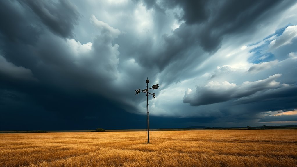
Signs of an approaching gust front include sudden temperature drops, shifting winds, darkening skies, an increase in cloud activity, and the presence of dust or debris being lifted. Observers often notice these changes moments before the front arrives.
Can Gust Fronts Cause Tornadoes or Severe Storms?
The question of whether gust fronts can induce tornadoes or severe storms is complex. While they can improve storm intensity and contribute to conditions favorable for severe weather, they do not directly cause tornado formation.
How Do Meteorologists Measure Gust Front Intensity?
Meteorologists assess gust front intensity through various methods, including Doppler radar, anemometer readings, and weather balloon data. These techniques help quantify wind speed changes and associated atmospheric conditions, providing understanding into potential storm development and severity.
Are Gust Fronts More Common in Certain Geographical Areas?
Gust fronts exhibit variability in occurrence across different geographical regions. Typically, they are more prevalent in areas experiencing intense thunderstorms, such as the Great Plains, where climatic conditions favor the development of strong convective systems.